When equipping an aerial vehicle with imaging equipment, it is important to make out the objects of interest with enough detail for the desired task at hand. This blog post explores the contributing factors to attaining a desired ground resolution (also known as the ground sampling distance (GSD)).
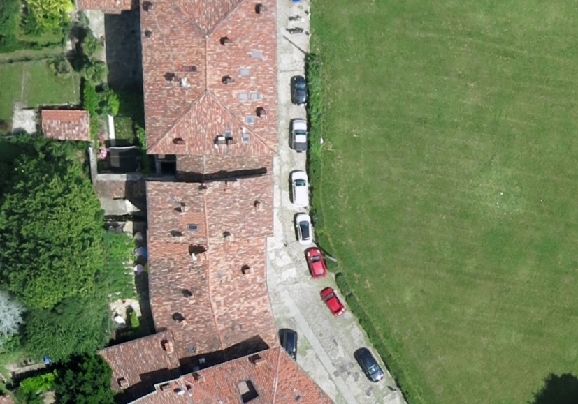
A higher ground resolution requires a smaller ground sampling distance. This equates to measuring an object in centimeters instead of in meters. The GSD should also be at least half of the size of the smallest detail to be measure optically. For example, when trying to detect cars from an aircraft, the ground sampling distance should be no larger than half of the width of the smallest car expected. However, if additional information is needed such as the make and model of the car, the GSD would need to be much smaller.
Factors that Matter
The contributing factors that determine the GSD are the aircraft’s height above the ground, the camera’s pixel size, and the lens’ focal length. Intuitively, the closer the aircraft is to the ground, the higher the ground resolution will be. As for the optics, a smaller focal length (known as a wide angle lens), will decrease the ground resolution. Finally, the smaller the pixel size, the higher the ground resolution of the system. This can be expressed mathematically as:
GSD: Ground Sampling Distance
H: Aircraft’s height above the ground
px: Linear dimension of the pixel
f: Lens’ focal length
Note: All units should be calculated in meters
Selecting the Right Camera
While the aircraft’s operational height above the ground may be set by its physical design or by regulations, the choice of the camera and its lens will help reach your required ground sampling distance.
When selecting a camera, there is more to consider than simply pixel size. Things like sensitivity, dynamic range, and read noise should all be factored into the decision. Our white paper on The Most Important Camera Parameters for Aerial Imaging goes through each one in terms of aerial imaging. However in this case, pixel size is the only factor that will determine ground resolution.
For example, the Lumenera LtX45R series of Sony Pregius-based global shutter CMOS cameras are available in 3, 5, 9, and 12 megapixel variants. It would be easy to assume that the Lumenera Lt1245R (12 megapixel), will yield a much higher ground resolution than the Lumenera Lt345R (3 megapixel). However, because all four of these cameras use sensors with the exact same pixel size (3.45 microns), the ground resolution generated by each is the same for a given height above the ground and lens focal length. What changes is the camera’s field of view or the amount of total visual information that is captured by the camera. When used with a lens that is matched to the camera’s sensor size, the Lt1245R will capture roughly double the height and double the width of the Lt345R.
The image below simulates the fields of view of both the Lt345R and the Lt1245R. This is what the field of view would be for these cameras at an identical height above the ground and using lenses with the same focal lengths. Images from each camera have the same ground resolution, but the images from the Lt1245R are four times as large.
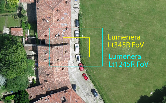
It becomes quite clear that a camera with a larger sensor allows much more ground to be covered. This helps reduce the total amount of flight time and bring costs down.
Learn More
If you have any questions about what pixel size or image sensor size would best fit your application, reach out to our imaging experts at [email protected].
And, sign up for our newsletter to automatically receive regular updates from Lumenera.
